


NEOLA Voting District, Pottawattamie County, Iowa
About
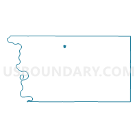
Outline

Summary
| Unique Area Identifier | 583268 |
| Name | NEOLA Voting District |
| County | Pottawattamie County |
| State | Iowa |
| Area (square miles) | 0.46 |
| Land Area (square miles) | 0.46 |
| Water Area (square miles) | 0.00 |
| % of Land Area | 99.25 |
| % of Water Area | 0.75 |
| Latitude of the Internal Point | 41.45163110 |
| Longtitude of the Internal Point | -95.61739760 |
Maps


Graphs
Select a template below for downloading or customizing gragh for NEOLA Voting District, Pottawattamie County, Iowa


Neighbors
Neighoring Voting District (by Name) Neighboring Voting District on the Map
- MINDEN TWP W/O NEOLA Voting District, Pottawattamie County, IA
- NEOLA TWP W/O NEOLA Voting District, Pottawattamie County, IA